
I’d heard a vague rumour about some waterfalls near Nanaimo. Heard they were called the Ammonite Falls. Heard they were one of Nanaimo’s hidden gems. I found a lovely photo of them on www.nanaimoinformation.com …

…so I said to Jamjarjude, let’s head into the woods to find the Ammonite Falls. It sounded like a good idea at the time. The sky was blue, the sun warm, the breeze fresh, and Ralphie was definitely up for a good walk.
Today, as I was writing this blog, I found these instructions to the falls posted by Dave Ingram on www.islandnature.ca — much clearer than I would have managed, especially since Jamjarjude, Ralphie and I took so many wrong turns and had to double back several times. Oh, how I wished we’d had this instructions yesterday. I’ll illustrate how our walk turned out….all in all it took us 3 hours rather than 40 minutes, so be prepared for taking wrong turns. And wear very good walking boots or running shoes. My comments in italics…
Directions to Ammonite Falls
Getting to the falls is pretty straightforward. From Jinglepot Road in Nanaimo look for Kilpatrick Road. This will take you to Jameson Road. Drive to the end of Jameson Road until it ends at Creekside Road. Park here along the side of the road. Jamjarjude pulled out her trusty Blackberry and googled a the best map we could find to the falls.

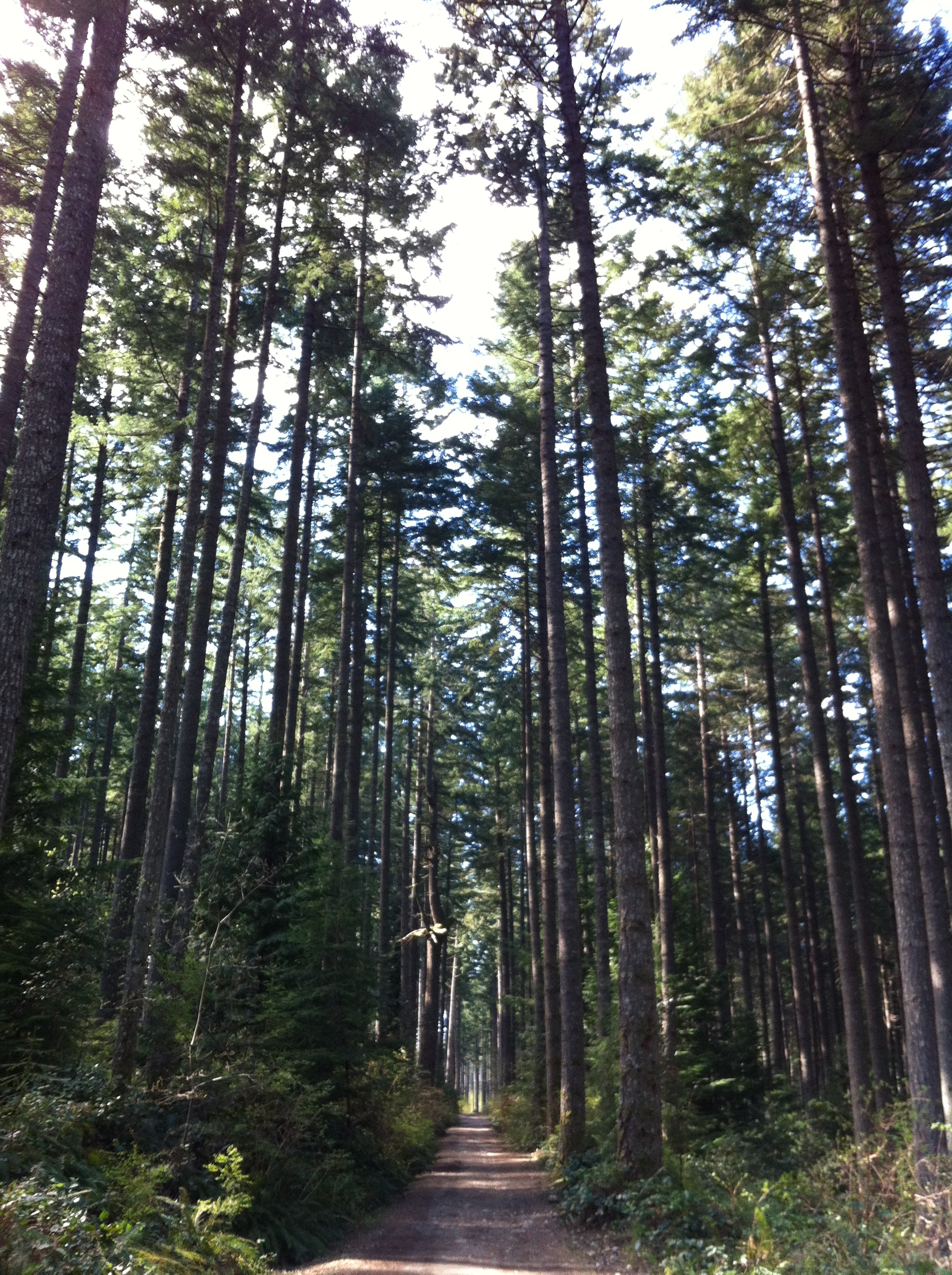
- Walk in on the gravel road past a yellow gate and into the Malaspina University College Woodlot. This bit was easy…

…and I admired how tall the trees were.


- Ignore the first gravel road to the left that goes up hill, continue straight through the managed forest. We went wrong here. First 45 minute detour up the hill…what can I say, there are no signs, and when you come to a fork in the path you go one way or the other, and we went the wrong way.

- Ignore the second gravel road to the right that goes down hill into a recent cut block. At this intersection you’ll see a sign post with a blue Benson Creek Falls Regional Park sign. Continue straight onto the lesser used gravel road. Okay, now we’re on the right path…

- Shortly after the road re-enters the forest you’ll see another Benson Creek Falls Regional Park Sign as well as a hand made sign which reads Ammonite Falls on the right.
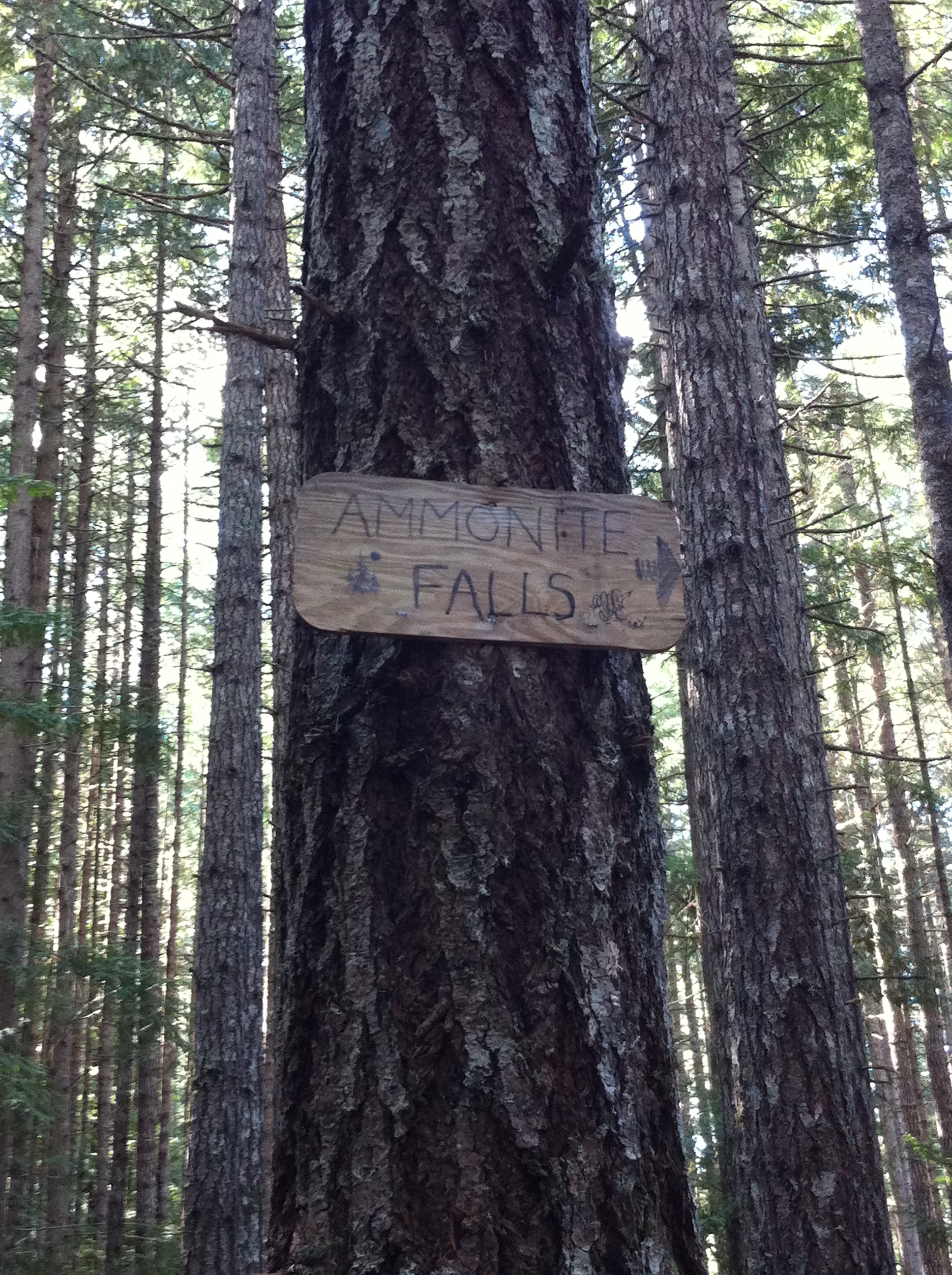
Ummm, a bit of a problem here, two signs pointing in different directions…
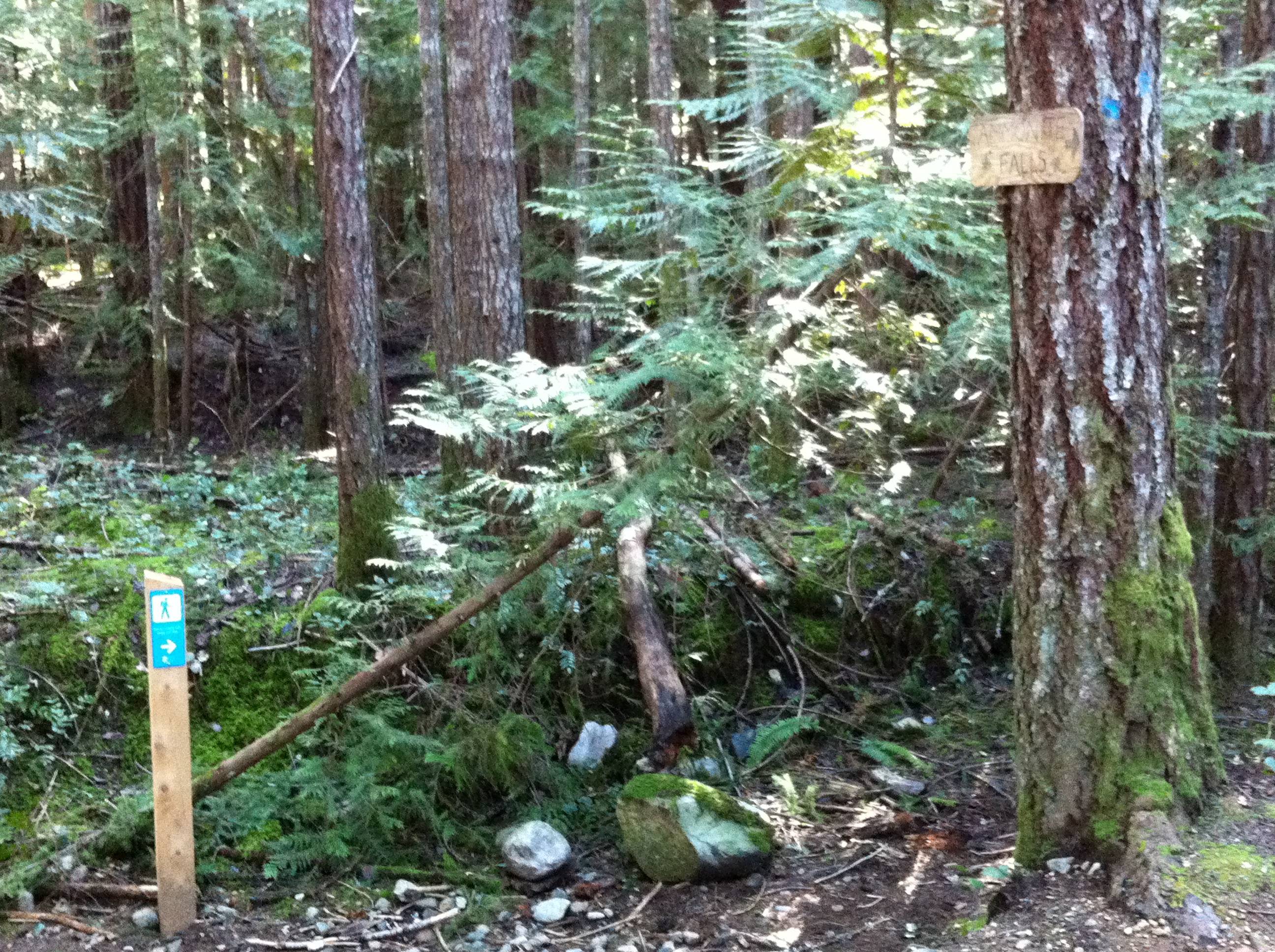
- A well trodden trail goes up and over a bit of a bank and then starts to descend right downhill toward a ridge that follows Benson Creek. You’ll hear it on your left. We followed the blue sign,..

…and came to a crossroads. Sigh. We’d already been left which was wrong, so we went straight, which we eventually found was wrong (another half hour later), so retraced our steps and went right, and headed downhill.

At the bottom of the hill the trail levels out along the top of a ridge that runs alongside Benson Creek. Jamjarjude spotted something on a hill that looked like a bear…

…because there are bears in these here woods. But it was just a tree stump. Phew.
You’ll see another blue sign for the regional park and a no littering sign along this stretch. Good, good, good!

It eventually comes out into a bit of an open area near the edge of a cut block. Here look for a trail on the left that follows the ridge (there were two but both joined on the down side of the slope). Keep to the woods and follow the sound of the stream. We’re on a roll…

- The trail goes down another hill to an open area at the top of the falls. There’s an old fire ring here. Which we saw. but I didn’t take a photo of it.
- Continue through the open area and follow the trail down toward the sound of the falls. It’s fairly steep in the first bit but gets steeper once you can see the falls.

- The final section is muddy, slippery and steep. There’s a set of ropes that you can use to assist you on the way down. Use caution and common sense. We saw the very steep, muddy, slippy, slidey bit and thought maybe today wasn’t the day we were meant to see the falls.
Allow yourself about 40 minutes from the trailhead to the falls. Yeah? No.
Now for the getting back to the car bit. Jamjarjude spotted a logging road which she suggested would get us back to the car faster…

…and it being flat, and the day being lovely, Ralphie and I concurred. It lead through some lovely woodland…

…and out into a cut block newly planted with seedlings…


